Research
Current Research Focus
Fusing of Heritage and Operational Ocean Color Sensors: I am focusing on developing an algorithm scheme that links inherent optical property measurements across CZCS, SeaWiFS, MODIS-Aqua, MERIS, VIIRS SNPP & NOAA-20, Sentinel 2 & 3, and Landsat 8 observations.
Water Quality Applications in Google Earth Engine: I am integrating water clarity algorithms into Google Earth Engine to increase the accessibility of satellite water quality monitoring data.
Previous Work
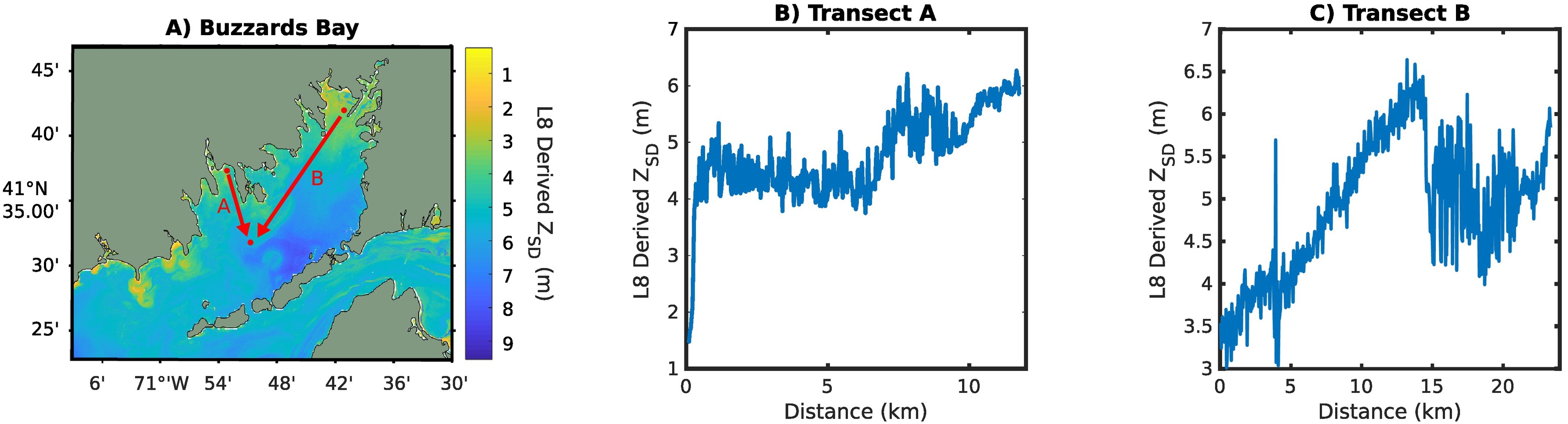
- Capturing Coastal Water Clarity with Landsat 8: This publication compiles Secchi Disk Depth (ZSD) measurements from New England water quality organizations to validate ZSD derivations from Landsat 8. Example code based on this work can be here.